National Park Atlas
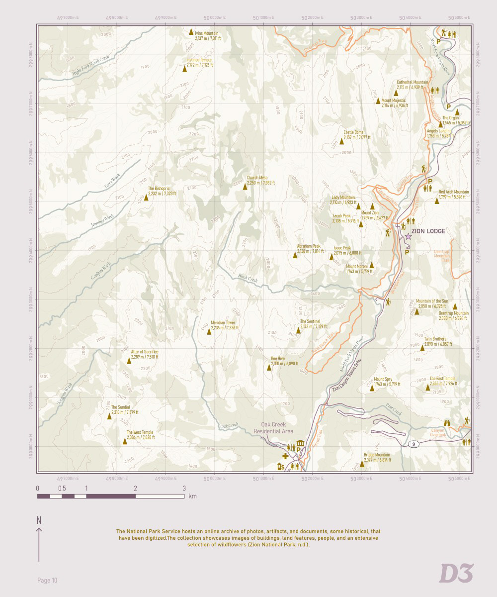
Zion National Park is put on display in this 19-page atlas. The selection here - cover, legend, keymap, and an example plate - demonstrate a balance between cartographic freedom and GIS proficiency. Data from USGS amongst other open national and state sources was distilled into 14 map plates that seamlessly describe essential information of the park. Attention to accuracy and generalization of information allow the ability for these maps to be used in real life wayfinding.
Key Skills
- Generalized geospatial information from large, government datasets using a variety of geoprocessing tools and techniques such as aggregating, simplifying, smoothing, delineating, and using Thin Road Network and the Topology Wizard.
- Generated layouts with ArcGIS Pro's Map Series function, creating a seamless mosaic of plates that make use of dynamic page features for consistent, cartographic design.
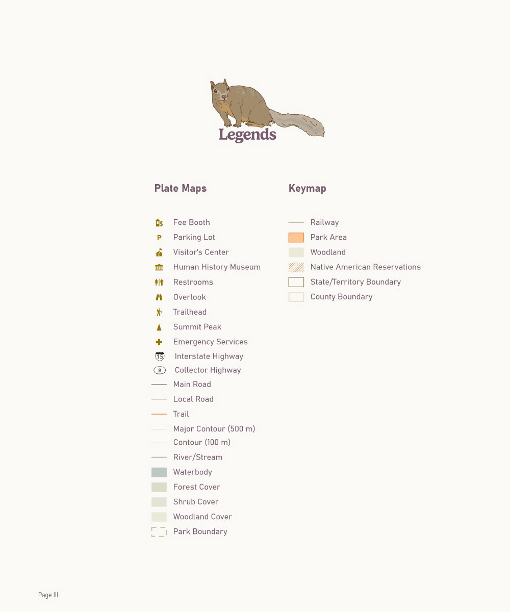
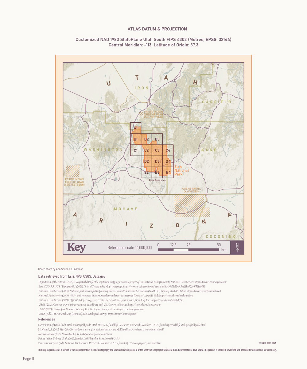
- Implemented important map surround and supplemental information for effective cartographic print material including legends, datum/coordinate system info, scales, keymap, table of contents, and references.
Software
- ArcGIS Pro
- Adobe Photoshop