Emergency Network Analysis
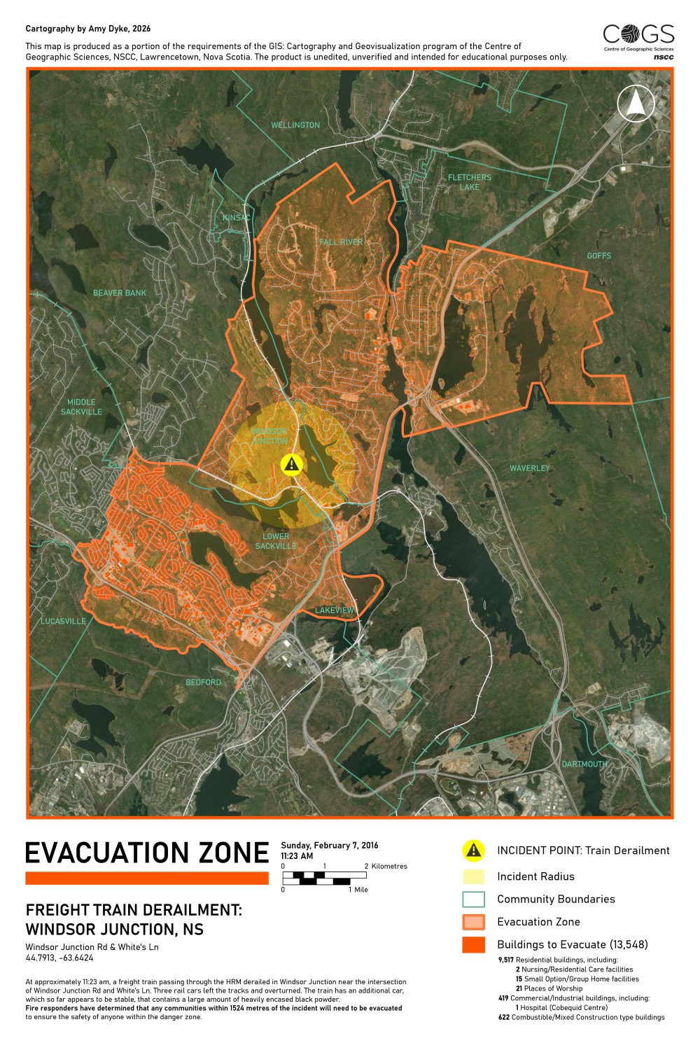
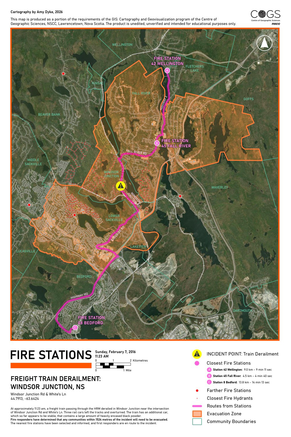
A mock scenario was created that described a freight train derailment within the Halifax Regional Municipality. The task as a GIS professional was to create four maps displaying information that was crucial to the emergency response. This project was completed entirely within ArcGIS Pro, including the use of Network Analysis tools in determining fastest routes and closest facilities and querying to select affected communities and suitable evacuation centers.
Key Skills
- Mapped accurate route plans and facility locations with the ArcGIS Pro Network Analysis tools Find Closest Facilities and Find Routes, realizing real-world data for cartographic and print outputs.
- Explored the GIS toolsets that play a role in an emergency planning and management context and expanding knowledge of the industries of map-making.
- Symbolized maps in consideration of emergency personnel as the client, combining basemap information with point, line, polygon, and analysis features for quick, observational overview.
Software
- ArcGIS Pro