ANIMATED Data DISTRIBUTION
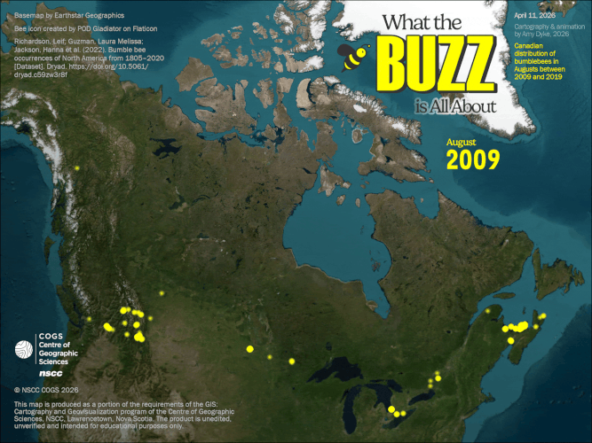
This animated gif was produced to show geospatial changes in data over time. The dataset features occurrences of bumblebees and how they are distributed across Canada in Augusts between 2009 and 2019. This animation was completed in ArcGIS Pro and benefitted from the use of time settings and the animation tab, filtering information into keyframes to stitch together as a complete piece of moving content.
Key Skills
- Refined tabular data through subsampling, spatiotemporal filtering, and temporal aggregation, generalizing and reducing phenomena to illustrate specific, thematic purposes.
- Activated time properties of spatial-temporal data in ArcGIS Pro, allowing only certain information to be shown at a given time to highlight certain aspects of phenomena and encourage spatial & change analysis.
- Configured the animation tab in ArcGIS Pro to section information into visuals, resulting in a series of keyframes ready for multimedia application.
Software
- ArcGIS Pro
- Microsoft Excel
- Free gif maker